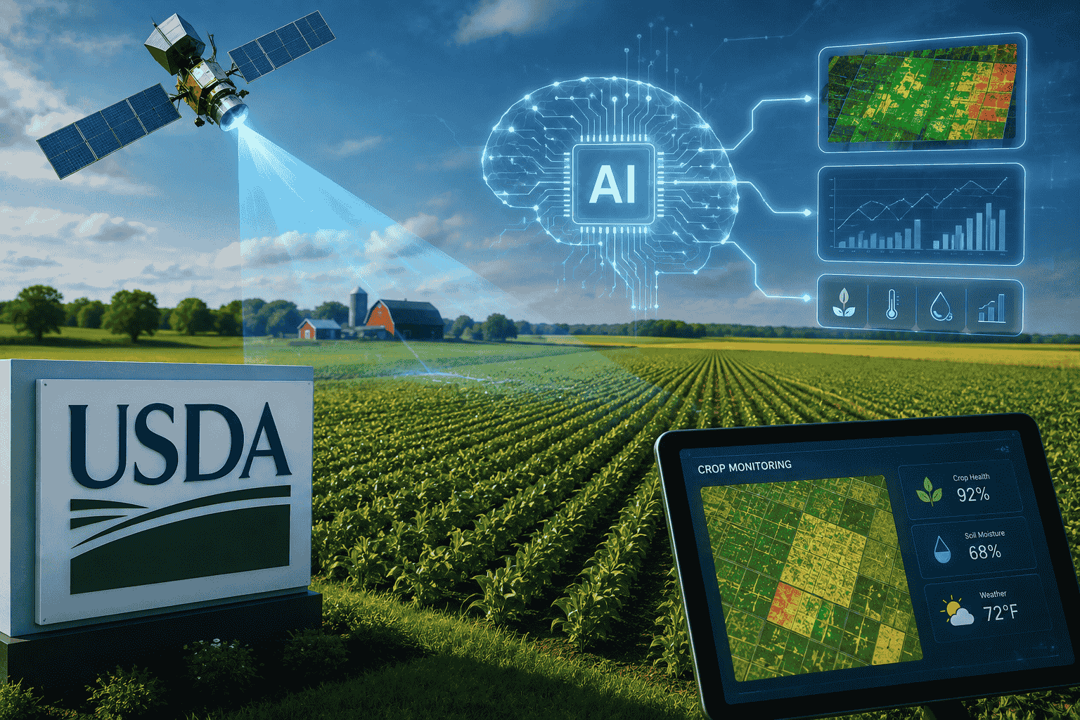
The U.S. Department of Agriculture (USDA) is moving toward a more technology-driven approach to crop forecasting, testing artificial intelligence, satellite imagery, machine learning, and other digital tools to improve the accuracy of U.S. agricultural estimates.
The initiative comes at a critical time for American agriculture. USDA crop reports influence commodity prices, planting decisions, farm income, food companies, and global agricultural markets. When estimates change unexpectedly, the consequences can spread well beyond farmers and traders.
The USDA’s new approach could therefore mark an important shift in how the United States measures its agricultural economy.
Why USDA Is Changing Crop Forecasting
The USDA has faced criticism over the reliability of some recent crop estimates, particularly after concerns surrounding 2025 data. At the same time, staffing and data-collection challenges have increased pressure on the department to modernize its system.
For decades, USDA agricultural statistics have relied heavily on farmer surveys, field observations, and statistical models. These methods remain important, but collecting accurate information across millions of acres is increasingly challenging.
Agriculture Secretary Brooke Rollins announced the new technology-focused approach during the 2026 Farm Progress Show in Iowa, highlighting the potential of satellite information, NASA data and precision-agriculture technology.
The goal is not simply to replace farmers’ information. Instead, USDA wants to combine traditional agricultural data with new sources that can provide broader and faster observations.
How Satellites Could Improve Crop Estimates
Satellite technology can provide a detailed view of agricultural land without requiring officials to physically visit every field.
Modern satellites can monitor vegetation, crop development, moisture conditions, and changes across large geographic areas. USDA’s National Agricultural Statistics Service already uses satellite imagery in programs such as the Cropland Data Layer, an annual crop-specific land-cover dataset covering the continental United States.
The new initiative could take this approach further by integrating satellite observations directly into crop acreage and yield estimation.
For example, satellite data could help identify how much land is planted with corn, soybeans, or wheat. It could also provide information about crop development and potential stress during the growing season.
This creates an important advantage: instead of relying exclusively on information collected from individual farms, analysts can compare survey information with large-scale observations from space.
AI Could Turn Agricultural Images Into Predictions
Satellite imagery by itself is valuable, but artificial intelligence could make the information significantly more useful.
Machine-learning systems can analyze enormous amounts of historical and current agricultural data. By comparing satellite observations with weather patterns, soil conditions, crop histories, and previous yields, AI models can identify relationships that may be difficult to detect through traditional analysis.
Researchers are already studying AI-based crop-yield forecasting because crop performance depends on complex and changing variables. Recent research has demonstrated the potential of machine learning to improve yield predictions at regional and field levels.
For USDA, the long-term opportunity is to create forecasting systems that continuously process new information rather than relying primarily on periodic surveys.
USDA Wants Faster and More Accurate Data
One of the biggest potential benefits of AI and satellite technology is speed.
Traditional agricultural surveys can take considerable time to collect, process and analyze. Satellite systems can provide observations across huge areas much more rapidly.
A technology-driven system could potentially identify changing crop conditions before they become obvious in traditional statistics.
This could be especially important during droughts, floods, heat waves, storms and other extreme weather events.
USDA already has experience using remotely sensed and geospatial data for near-real-time agricultural disaster assessments, demonstrating that satellite technology is not entirely new to the department.
The new initiative represents a broader attempt to make these technologies part of the core crop-estimation process.
Why Crop Forecasts Matter to Farmers and Markets
USDA crop reports have an influence far beyond government statistics.
Farmers use production estimates when deciding when and how much to plant. Grain traders use forecasts when evaluating commodity prices. Food manufacturers use them when planning procurement. Exporters use them to assess international supply.
A change in expected corn, wheat or soybean production can therefore move markets quickly.
More accurate forecasts could reduce uncertainty throughout the agricultural supply chain.
For farmers, better information could also improve decisions about storage, marketing and crop planning. For investors and commodity traders, more reliable data could provide a clearer picture of supply and demand.
AI Could Help Detect Crop Stress Earlier
Another major opportunity is early detection.
Agricultural AI systems can analyze vegetation patterns and identify signs of drought stress, disease, nutrient deficiencies or other problems.
Satellite imagery can capture changes in vegetation that may not be immediately visible from ground level. When combined with weather and historical crop information, machine-learning models could help determine whether changing vegetation conditions are likely to affect final yields.
This could become increasingly important as extreme weather creates greater uncertainty for global agriculture.
The technology could also complement precision farming, where farmers use data to apply water, fertilizer and crop-protection products more efficiently.
Farmers Will Still Be Important
Despite the growth of AI, technology is unlikely to eliminate the role of farmers in USDA crop forecasting.
Satellite systems can observe fields, but farmers possess detailed knowledge about planting conditions, crop management and local problems that may not be visible from space.
The USDA’s modernization effort is therefore better understood as a combination of human knowledge and technology.
Officials have also discussed improving digital communication with farmers, including online surveys and pre-filled information fields. The objective is to make data collection more efficient while reducing unnecessary reporting burdens.
The Challenges of AI-Based Agriculture
AI-powered crop forecasting will not be without challenges.
Satellite images can be affected by cloud cover and other technical limitations. Different crops can sometimes appear similar from space. Weather conditions can change rapidly, making predictions difficult.
AI models also depend heavily on the quality of the data used to train them. If historical information contains errors or gaps, an algorithm could reproduce those weaknesses.
Another challenge is transparency. USDA crop estimates are closely watched by farmers and financial markets, meaning the department will need to demonstrate that new technology produces reliable and understandable results.
The best approach may therefore be a hybrid system combining surveys, field observations, satellite imagery, weather information and AI models.
What This Means for the Future of Farming
The USDA’s initiative reflects a much larger transformation taking place across agriculture.
Farming is increasingly becoming a data-driven industry. Drones, autonomous equipment, GPS systems, sensors, satellite imagery and artificial intelligence are creating enormous amounts of information about crops and farmland.
USDA’s move could accelerate this transformation at the national level.
If the pilot proves successful, agricultural forecasting could eventually become more continuous, automated and geographically precise. Instead of relying mainly on periodic snapshots, policymakers and markets could receive increasingly dynamic assessments of crop conditions.
AI, Satellites and the Future of Food Security
The implications extend beyond American farms.
The United States is one of the world’s most important agricultural producers and exporters. More accurate estimates of American corn, soybean and wheat production can influence international commodity markets and global food supplies.
As climate change increases weather volatility, better forecasting could become an important tool for managing food-security risks.
Satellite monitoring and AI will not eliminate droughts, floods or crop failures. However, they can potentially give farmers, governments and businesses more time to respond.
Conclusion
The USDA’s decision to test AI, satellite imagery, and machine learning for crop forecasting could represent a major modernization of America’s agricultural data system.
The technology will not replace farmers or traditional statistics overnight. Instead, it could add a powerful new layer of information to the forecasting process.
If successful, the combination of artificial intelligence, satellite monitoring, precision-agriculture data and human expertise could produce faster and more accurate crop estimates.
For farmers, traders, food companies and policymakers, that could mean better decisions and less uncertainty. For the broader agricultural industry, it could signal the beginning of a new era in which data and AI become as important to crop forecasting as soil, weather and farming experience.
FAQs
1. Why is USDA using AI for crop forecasting?
USDA is testing AI and modern data technologies to improve the accuracy and efficiency of crop acreage and yield estimates.
2. How can satellites help agriculture?
Satellites can monitor large agricultural areas and provide information about crop coverage, vegetation and field conditions.
3. Will AI replace farmers in USDA surveys?
No. The technology is intended to complement traditional data collection and farmer information rather than eliminate farmers’ role.
4. Can AI predict crop yields?
AI can analyze historical yields, weather, satellite imagery and other information to produce crop-yield forecasts, although predictions still involve uncertainty.
5. Why are USDA crop reports important?
They influence farming decisions, commodity markets, food companies, exports and agricultural policy.
6. What crops could benefit from improved forecasting?
Major U.S. crops such as corn, soybeans and wheat could benefit from more accurate acreage and yield estimates.
7. Is USDA already using satellite data?
Yes. USDA programs already use satellite imagery and geospatial technology for crop mapping and agricultural monitoring.
8. What is the biggest benefit of AI crop forecasting?
The biggest potential benefit is combining large amounts of information quickly to produce more timely and accurate agricultural estimates.
9. What are the risks?
Poor-quality data, technical limitations, extreme weather and model errors can affect AI predictions.
10. Could this change the future of farming?
Yes. If successful, the technology could accelerate the shift toward data-driven, precision and digitally connected agriculture.